Looking for design inspiration?   Browse our curated collections!

Previous Image

|

Next Image
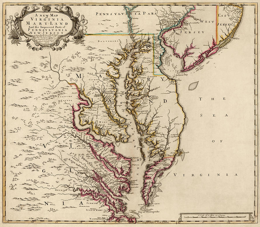
Maryland Map Drawing - Antique Map of Maryland and Virginia by John Senex - 1719 by Blue Monocle

Antique Map of Maryland and Virginia by John Senex - 1719 is a drawing by Blue Monocle which was uploaded on January 8th, 2014.

Similar Images

Antique Map of Virginia and Maryland by Augustine Herrman - 1673 by Blue Monocle
Antique Map of Baltimore Maryland by Sidney and Neff - 1851 by Blue Monocle
Antique Map of Maryland by Fielding Lucas - circa 1817 by Blue Monocle
Antique Map of Virginia and Maryland by John Smith - 1624 by Blue Monocle
Antique Map of Baltimore Maryland by Samuel Augustus Mitchell - 1863 by Blue Monocle
Antique Map of Baltimore, Maryland, Currier and Ives, 1880 by Blue Monocle
Antique Map of Virginia and Maryland by John Farrer - circa 1667 by Blue Monocle
Old Map of Maryland and Delaware - 1893 by Blue Monocle
Antique Map of the Middle American Colonies by Johann Baptist Homann - circa 1759 by Blue Monocle
Antique Map of Washington DC by Andrew B. Graham - 1891 by Blue Monocle
Vintage Map of Baltimore, Maryland, 1901, Blueprint Style by Blue Monocle
Vintage Maryland Relief Map by Blue Monocle
Vintage Maryland Road Map, Blue on Beige #1 by Blue Monocle
Vintage Maryland Road Map, Blue on Beige #2 by Blue Monocle

Recently Viewed

Antique Map of Maryland and Virginia by John Senex - 1719 by Blue Monocle
Previous Image Next Image